Introduction
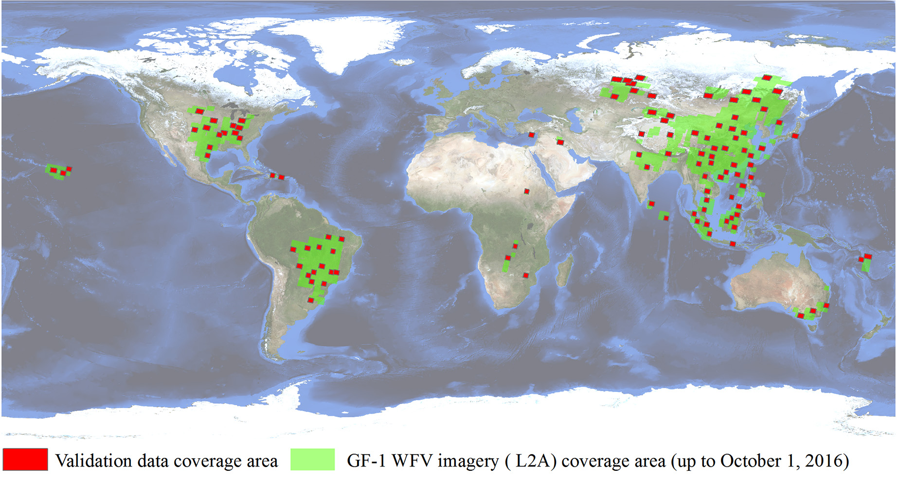
The SENDIMAGE Lab. released this validation datasets which includes 108 GF-1 Wide Field of View (WFV) level-2A scenes and its reference cloud and cloud shadow masks. The datasets were used for evaluating the performance of the MFC algorithm which is proposed for cloud and cloud shadow detection in GF-1 WFV imagery. The globally distributed validation images were acquired from May 2013 to August 2016. The reference masks were obtained by manually drawing cloud/cloud shadow borders after visual inspection by experienced users.
The scenes are provided in .tar.gz format, and the masks in .tif fromat in which each DN value denotes:
| Value | Class |
|---|---|
| 0 | NoValue |
| 1 | Clear |
| 128 | Cloud Shadow |
| 255 | Cloud |

Fig. 1. Global distribution of the validation data (base map credit: NASA Visible Earth). The data coverage information for the GF-1 WFV imagery was obtained from the China Centre for Resources Satellite Data and Application (CRESDA) (www.cresda.com).

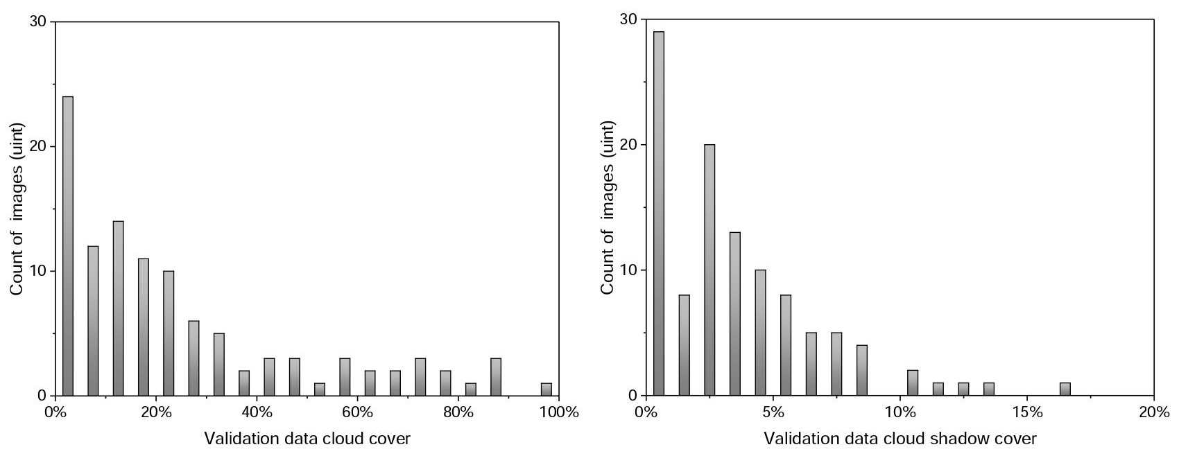
Fig. 2. The histogram distribution of cloud and cloud shadow fractions across the validation images.
The full GF1_WHU dataset can be downloaded at Baidu Disk (password: rbwb) or Google Drive. Any questions, contact Dr. Zhiwei Li at lizw(at)whu.edu.cn. This dataset is shared for academic purpose only. If you use the dataset, you should appropriately cite our paper:
Li, Z., Shen, H., Li, H., Xia, G., Gamba, P., & Zhang, L. (2017). Multi-feature combined cloud and cloud shadow detection in GaoFen-1 wide field of view imagery. Remote Sensing of Environment, 191, 342-358. (PDF)
