Cirrus clouds are commonly distributed in the atmosphere, and can lead to degradation of the ground information in optical remotely sensed images. A cirrus band on the Landsat 8 Operational Land Imager (OLI), i.e., Band 9, is designed to precisely detect cirrus cloud, providing a reference basis for the radiance calculation of cirrus cloud in other bands. Therefore, based on a scattering law, a cirrus cloud correction method is proposed in this paper to restore the ground information for Landsat 8 OLI visible and near-infrared (VNIR) images by comprehensively using the visible and cirrus bands. The scattering law and the high correlation between the two adjoining blue bands are combined to estimate each VNIR band’s cirrus radiance. The relationship among the bands is constrained to comply with the scattering law. In the experiments conducted in this study, both simulated and acquired images contaminated with cirrus cloud were used to evaluate the proposed method, and both visual and quantitative evaluations were carried out to verify the performance. The results suggest that the cirrus cloud in the VNIR bands can be removed by the use of the proposed method.

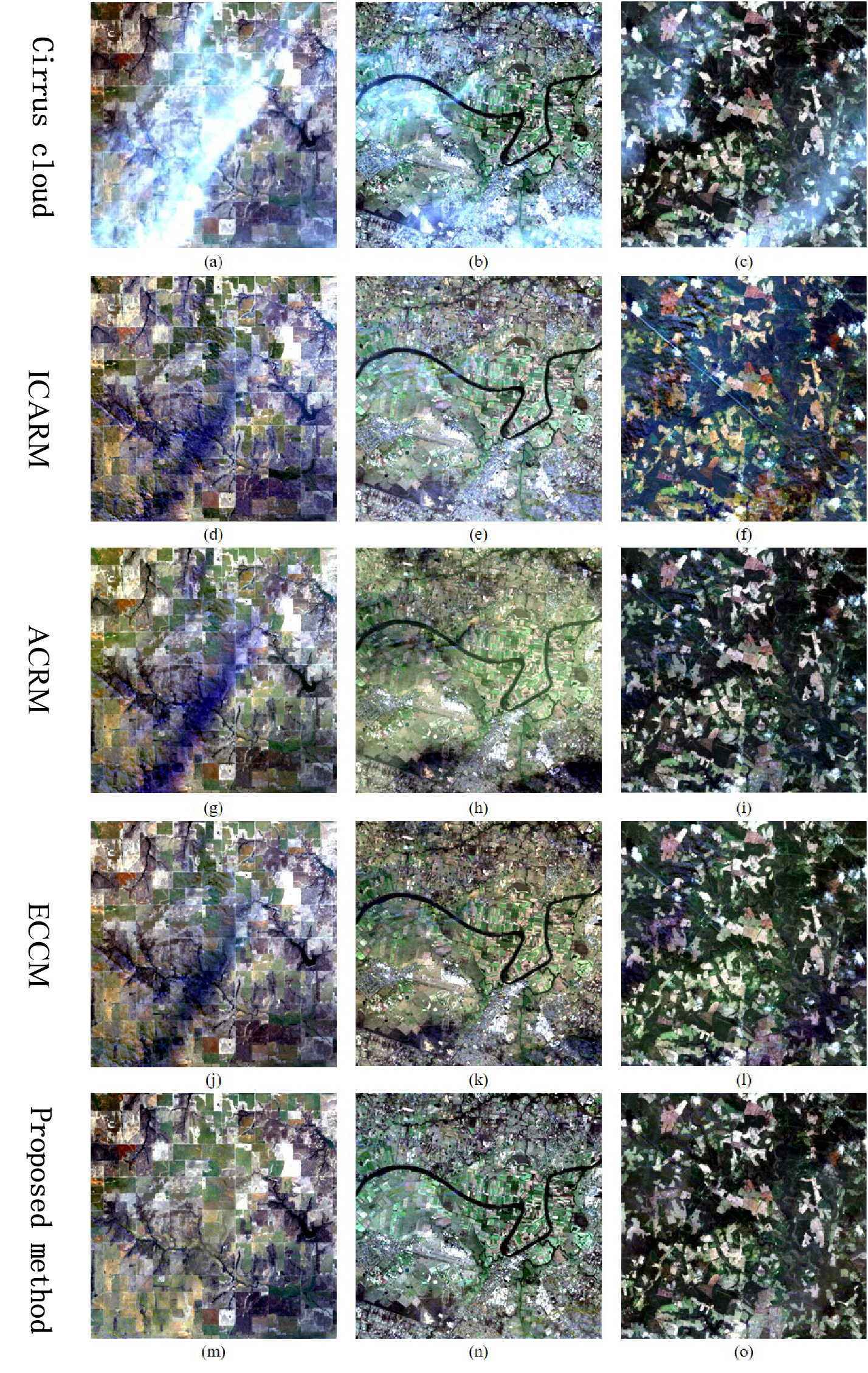
Figure 1. Three acquired cirrus cloud images with complex land-cover types. The first row shows the three acquired cirrus cloud images with complex land-cover types.
The second to fifth rows show the results of ICARM, ACRM, ECCM, and the proposed method.
查看详细>> C. Zhang, H. Li, and H. Shen, “A scattering law based cirrus correction method for Landsat 8 OLI visible and near-infrared images,” Remote Sensing of Environment, vol. 253, pp. 112202, 2021.
