
遥感数据时间分辨率和空间分辨率的不可兼得性,以及其容易受到云等因素的影响往往使得遥感数据存在时空不连续问题,严重影响了城市热岛的研究。本研究针对上述问题,利用多时相以及多传感器遥感数据融合技术并结合NOAA-AVHRR, Terra-MODIS, Landsat-5 TM, Landsat-7 ETM+, and Landsat-8 OLI/TIRS传感器数据,生成了武汉市夏季1988年到2013年每年的地表温度数据。利用该数据定性以及定量分析了武汉市夏季城市热岛的时空动态变化。并尝试通过添加时间维度,将地表温度与植被以及不透水层之间的2维相关性扩展到了3维分析。结果表明,武汉市高温区(红色)和亚高温区(黄色)不断的从农村向中心城区转移,而老城区的高温区(红色)则呈现一种分散分布的趋势。值得注意的是,在这26年里,武汉市的热岛强度呈现一种先增加后减小的趋势。城区与农村的最大温差都发生在2003年,其中老城区与农村的温差最大为7.19 K而三环区与农村的最大温差为4.65 K。最后发现,武汉市地表温度与植被以及不透水层之间的相关性是年际稳定的。
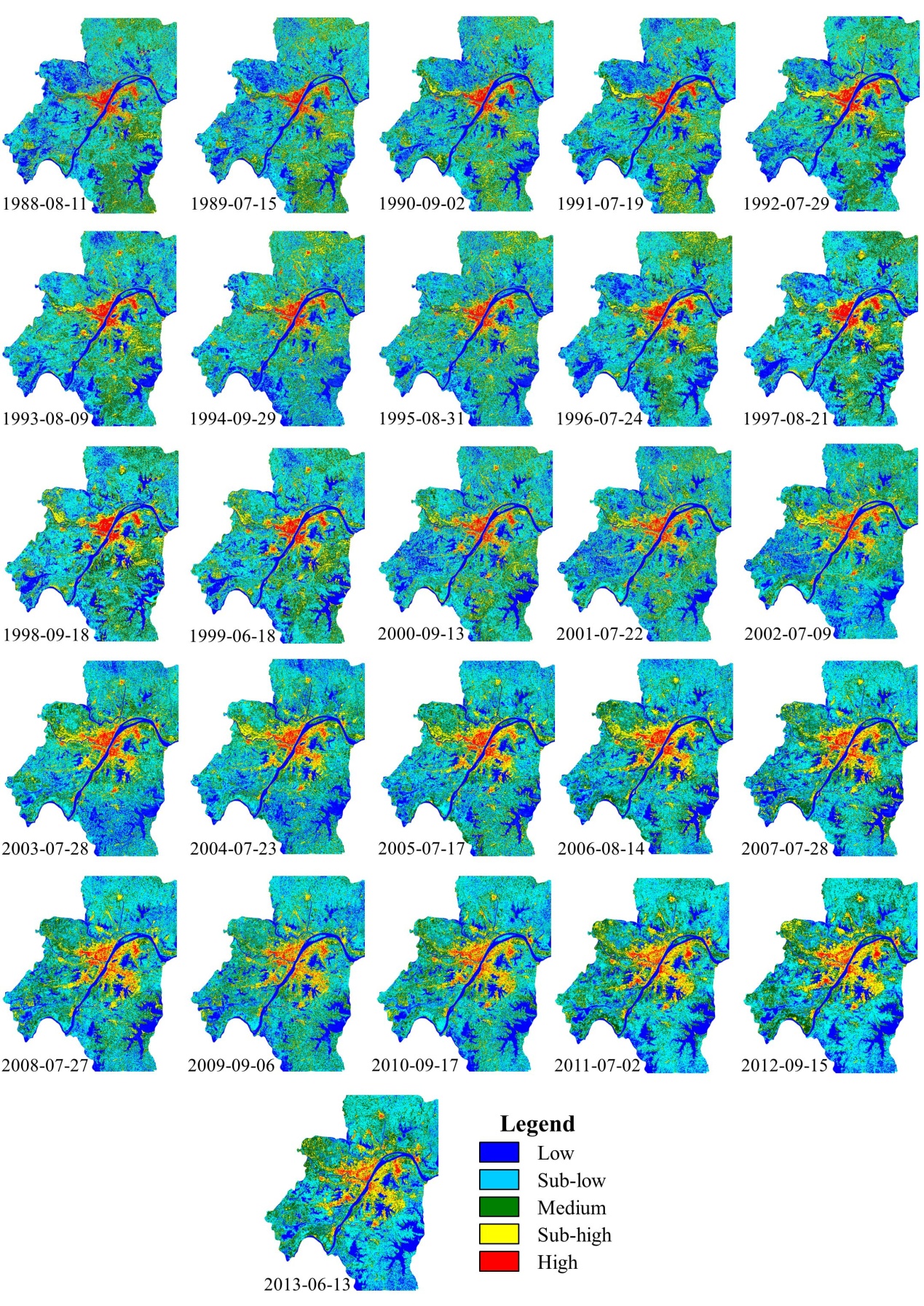
Summer LST distribution forWuhan from 1988 to 2013, after the temporal filtering.
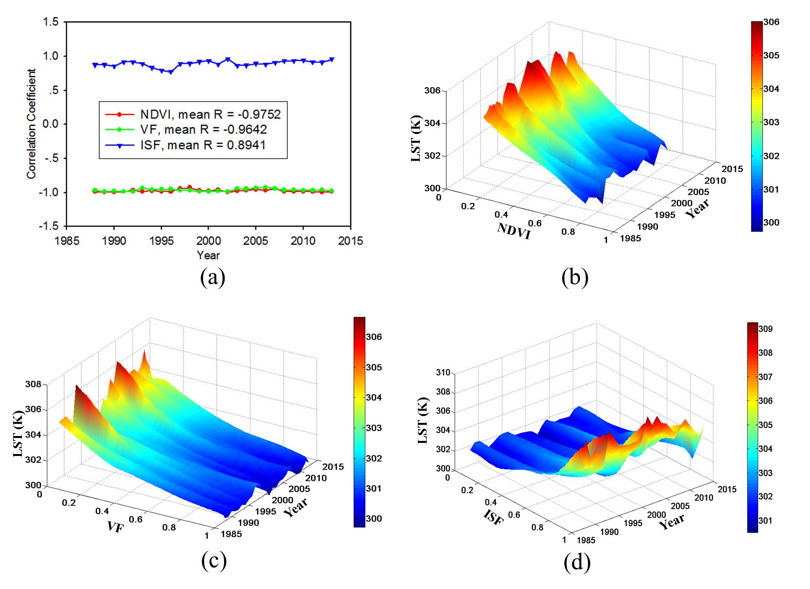
The spatio-temporal relationships betweenmean LST and the NDVI, the VF, and the ISF. (a) The correlation coefficients between LST and the NDVI, the VF, and the ISF. (b) The 3D relationship between LST and the NDVI. (c) The 3D relationship between LST and the VF. (d) The 3D relationship between LST and the ISF.
查看详细>> H. Shen, L. Huang, L. Zhang, P. Wu, and C. Zeng, “Long-term and fine-scale satellite monitoring of the urban heat island effect by the fusion of multi-temporal and multi-sensor remote sensed data: A 26-year case study of the city of Wuhan in China,” Remote Sensing of Environment, 2016.